The idea behind
The European Land-use InstituteLand system research is a multidisciplinary field that was faced since ever with a high and continuously increasing level of complexity. A well-known reason for an increase in the complexity is the dynamic nature of environmental parameters
 (climate, site conditions, etc.), which leads to large uncertainties in predicting their development and mutual interferences (i.e. ecosystem responses on climate change).
Also, even though most environmental data are officially available from monitoring or public data bases, access is often difficult and accessible data are highly heterogeneous regarding their reference scale (temporal / spatial) and assessment purpose (ecosystem processes monitoring socio-ecological systems parameter assessment ). Related is the question of the selection and interpretation of suitable criteria and indicators which enable, for instance, an integrated assessment of the multiple processes and their effects on sustainability or - more concrete - provision of ecosystem services. There is an excessive number and variety of indicators to assess the impact of human activities on the environment at different scales - which impedes the interpretation and harmonization of indicator-based approaches and limits their usefulness in supporting land management and land use planning decisions.
 Furthermore, multiple stakeholders with often conflicting interests are addressed and wish to participate in management and planning decisions. Policy making and decision processes happen at macro to micro scale and have to consider that actors might argue with different macro- or microeconomic point of view. Cross-sectoral policy making processes in agriculture and forestry as requested in realizing the renewable energy provision targets in Europe might serve as an example. In a society characterized by globalization effects, interactions between agencies and institutions at an international level impact additionally such processes at regional and local scale. Increasing demands from a public that is scrutinizing regional planning and land management decisions and their effects on environmental conditions and ecosystem services add additional complexity.
Researchers and practitioners in land management and land use planning are being confronted not only with an increasing number of demands, rules, regulations and directives but
 also with an increasing diversity and detailedness in knowledge: processes in single ecosystems might trigger large scale processes at global scale, taking Carbon sequestration and Climate Change as an example. Other processes or target variables such as species diversity might be dependent from the quality of single habitats, but also of their spatial context at landscape scale. Forest and agricultural land use models refer mostly to the micro scale and neglect the impact of different spatial constellations of the land use types and of their mutual impact, which - however - might be critical aspects for a proper understanding and assessment of ecological processes and functions. Also, only few models are compatible in their temporal and spatial resolution, an aspect which complicates, for instance, the impact assessment of land use changes if several models and model types are used in parallel.
 Such complexity makes it difficult to simply answer the question which knowledge base or rule to apply and whose demands to consider primarily at different interdependent spatial scale levels. An example therefore is spatial planning, which addresses explicitly different scale levels in decision making and knowledge integration. Regional planers face the problem to bring together land management knowledge (micro scale) and needs of society. They should integrate both in estimating regional (meso - macro scale) potentials to provide requested resources and services while respecting at the same time land tenure aspects.
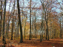 Another example - for the complexity to integrate different time scales - is forest management planning with its division into strategic (long term = at least one rotation period) planning, tactical (mid-term = up to 30 years) planning and operational (short term = up to 10 years) planning. Strategic planning in forestry must necessarily respect development, resource provision or protection targets from politics and society. Once a strategic decision such as conversion of coniferous into deciduous forest stands is made, tactical and operational planning are forced to translate this decision into concrete planning measures and operations. In case, a strategic decision must be revised due to new, complementary or competing regulations, managing the tree species composition and stand structure according to a new strategy is difficult or its adaptation takes at least several decades.
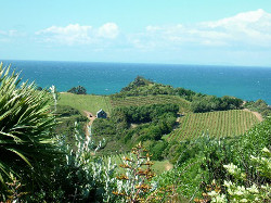 In conclusion, research on land systems and integrated land use requires bringing together knowledge and methodological approaches from different land use sectors, such as agriculture, forestry, water management, urban, commerce and industrial systems to ensure a holistic point of view. This comprises harmonization and integration of different datasets, standardization of indicator selection, consensus on the reference scale, and development of approaches or systems that support integration of qualitative and quantitative knowledge.


